A Step by Step Guide to the Mt Sentinel Hill Climb
Course Preview


GPS Routes and Mile Markers for both Options (Blue = Northern Route & Red = Southern Route)
 |
| Elevation Profile for the Northern "Ridge" Route |
 |
| Elevation Profile for the Southern Route |
So now that you've got the numbers, what should you do on race day? Well that depends on your preferences for trail surface, scenery and pain! For those of you who enjoy a solid, compact trail surface, like to keep the legs ticking over and don't mind the extra distance and elevation gain then the Southern Route is for you. If you live for challenge, don't mind loose dirt and rock in your shoes and aren't afraid to hike or walk when you hit that 51% slope then keep left after the "M" and try your luck on the Northern "Ridge" Route! No matter which way you choose to go on race day, your journey begins in the same place.
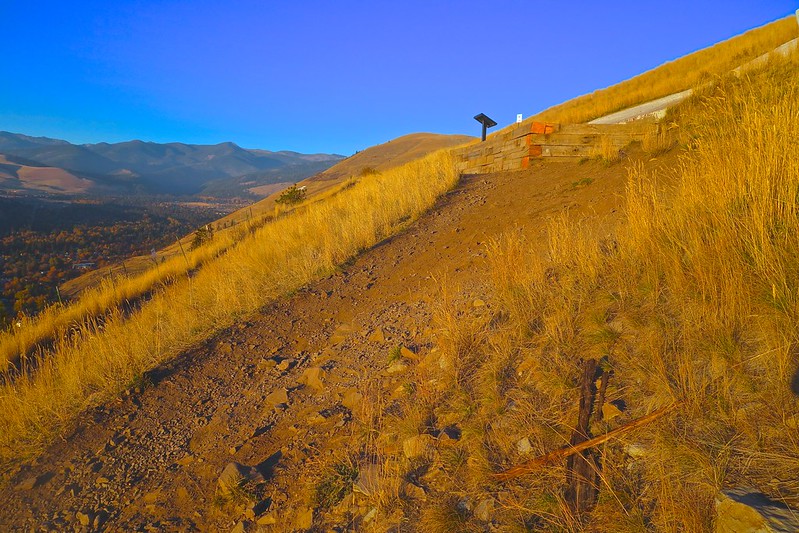
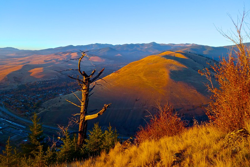
Section 1: The "M" Trail
(0.75 miles and 680ft elevation gain)
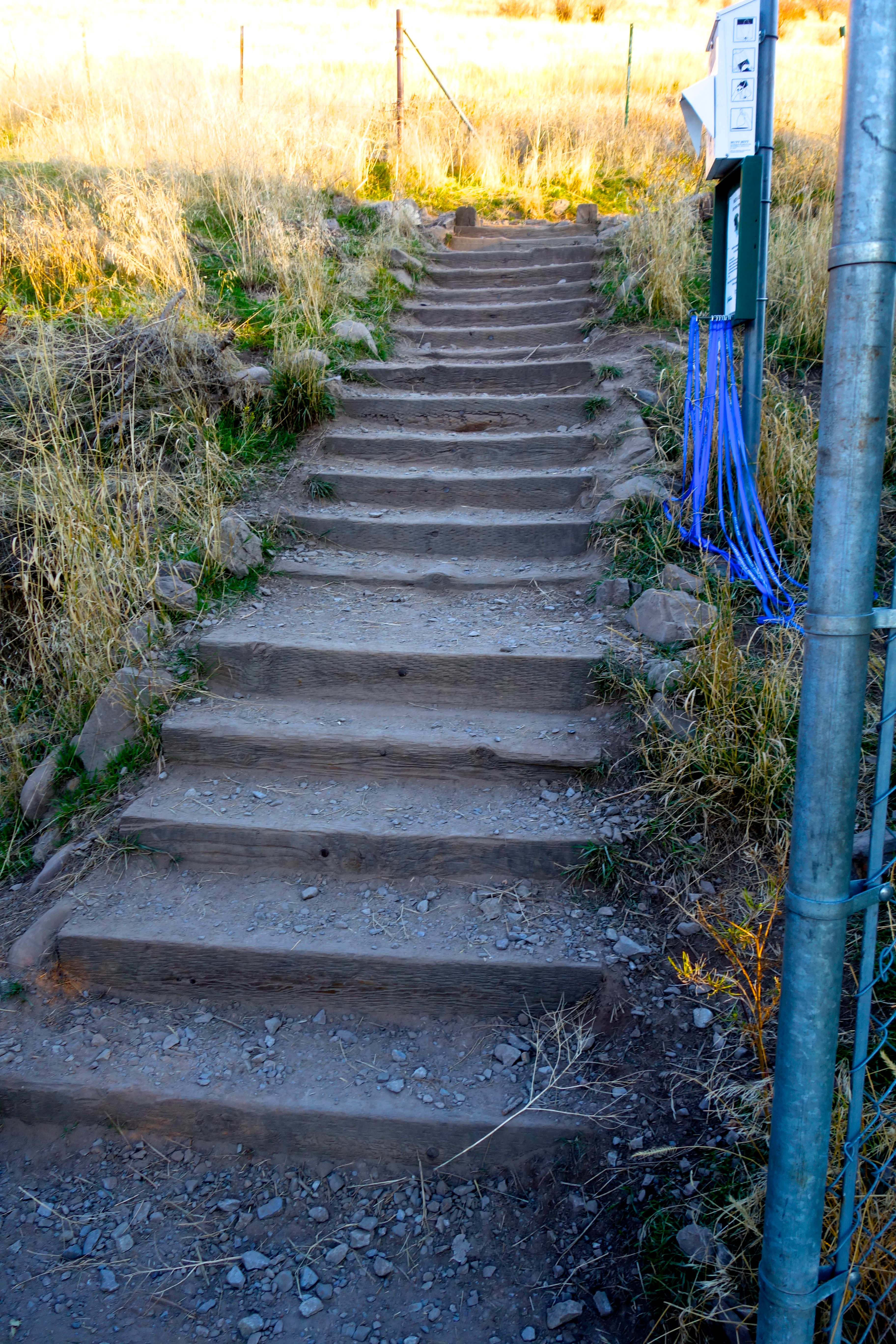 |
| Entrance to Mt Sentinel and the "M" Trail Switchbacks |
Let's imagine it is Sunday and race day is here. You woke up your in own bed (nice), ate a light breakfast, put on your lucky race day gear, rode your bike to the start (awesome) and RD Mike Foote, who hates Sentinel repeats, is barking instructions at you. You look back at your family one last time, who are supporting you but quietly thinking "glad its not me running up that thing", as you prepare mentally for the oncoming roller coaster of excitement and struggle. Everyone nervously tucks into the long line that is now pointing upward towards the summit. You're running through your strategy, checking your shoe laces and all of a sudden we're off... Immediately your nerves calm and you start to think about this course preview... wait where was the North "Ridge" turnoff again?
 |
| First Climb of the Day on the Gentle but Rocky Switchbacks of the "M" Trail |
 |
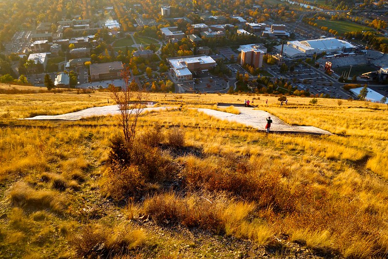
| Looking Down the "M" Trail towards the UM Campus |
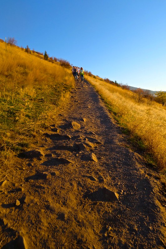
Just like that, your past the half mile mark and you're starting to feel the climb in your legs as you sneak views of the runners zig zagging behind you. You've reached the point now where we all start searching for that metal sign post that sits right in front of the "M" but its still several switch backs up. So you put your head down and keep climbing, you'll be there soon enough.
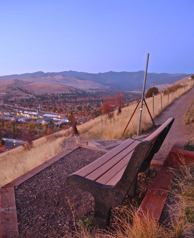 |
| Really Comfortable Benches with Great Views of Missoula Strategically Placed to Keep You from the Summit |
The newly built benches seem like a great idea but you avoid them because you want to make it the entire way without stopping. Smart decision! Why make this any longer than it has to be, right?
 |
| The Final Switchback before the "M". The Metal Sign Post is Actually a Map Donated by the 2012 UM Senior Class. |
Finally, you catch a glimpse of that metal sign post! You swing left at the last switchback and come face to face with the first and last stretch of flat trail on your way to the summit. Nice work! Enjoy the short reprieve, take in the well-deserved view of the Rattlesnake Mountains to the North and get ready to make the most important decision of the day...
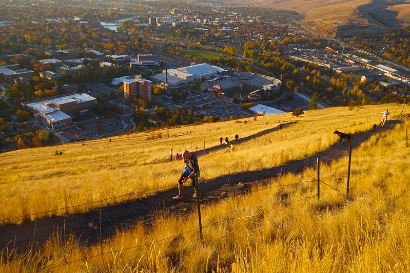
Section 2: Glacial Lake Missoula Rock
(0.5 Miles and 695ft of Elevation Gain)

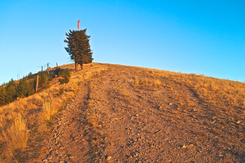
"M" Trail Sign Pointing to the Sentinel Fire Road Just above the "M"
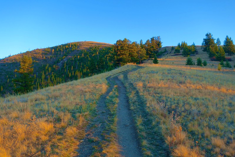
This next section is critical to your race experience so pay attention. You've now climbed up over the "M" and you notice something odd. The other racers in front of you are going in different directions. Despite the growing inward fear that you are lost, you think back to this post and remember that this is the critical trail junction where you must choose between the Northern and Southern routes. The beautiful weather coupled by your eight hours of sleep and 2 shots of espresso encourage you to go for the Ridge. Gutsy, I like your style! Now it's time to focus.
So you've committed yourself to the shorter but steeper route, nice, there's no turning back now. You're focused and looking at the rocky, narrow trail about 3 feet in front of you, scanning for rocks and turns. Yes, there are some gnarly climbs just ahead but you're not worried about them right now. Keep reminding yourself that this is what trail running is all about. This definitely hurts but its kind of fun!
 |
| Junction of the Sentinel Fire Road and Ridge Trail |
Now you've made it over the first of a series of unbelievably steep climbs and your confidence is up. The trail is technical but you've got it today. Even with your new found confidence, you are still cautious because there is still 3/4 of a mile to go and there is a rather steep drop off to the Clark Fork on your left! Steady.

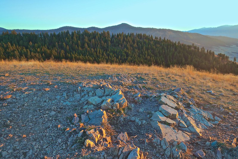
The race has really spread out now. You just passed a few of the runners who gambled on the all out sprint to the summit strategy and of course there's that guy who has been right behind you since the start. Even your best surges just can't seem to shake him. Don't worry about him, focus on finding the Glacial Lake Missoula rock to your left. No reason why you can't take in a little history on your way to the summit.
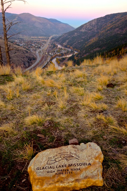 |
| The Glacial Lake Missoula Rock Resting at 4200ft Just before the 1 Mile Mark |
 |
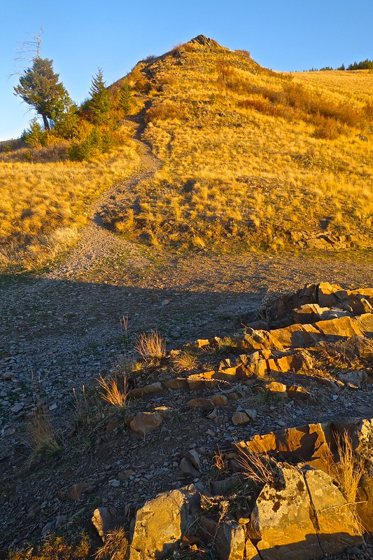
| A Junction from the Ridge Trail Leading into the Woods and the Gentler Southern Route to the Summit |
Section 3: Paraglider Wind Sock
(0.37 Miles and 490ft of Elevation Gain)
 |
| Looking West from the Ridge Trail to Mt Jumbo and The Rattlesnake Mountains |
Less than a half mile to go! Mt Jumbo looks so small from up here, God I love this place. You've earned this view so certainly take it in but don't linger. Remember, the last section is where you are going to pull back that group in front of you and finally break free from that stubborn guy who is breathing heavy behind you. Yeah, he stills there!
 |
| First View of the Mt Sentinel Summit |
The trail now looks more like a jeep road than single track. You have been patiently waiting for this semi-flat section to begin your final push to the summit. If you squint you can just make out the inflatable finish line arch that someone from the Runner's Edge drove all the way up to the summit...nice touch guys!

Well, that little push paid off. You passed an entire group of runners and you're still holding that last gear for the final pitch to the summit. Remember to watch out for the water bars on this last steep section. Also, don't forget to enjoy the narrow single track here because this is the last of it.

Ah yes, the final turn to the home stretch. There is a beautiful view just off to your right, of the jagged Bitterroots, the snow capped Lolo Peak and the distant peak of Cha-Pa-Qnn but you don't look, instead you climb hard to the left. So close!
 |
| The Infamous Paraglider Wind Sock - A Beacon of Trust for All Sentinel Recreationists |
Yes, the Wind Sock, finally! You now have undeniable proof that the summit is just a hundred yards or so away. The trail really expands here and the overlapping braids can be a bit awkward. Pick a straight line and stick to it. You swear you can hear voices up ahead but you still can't see the finish yet. Time to throw caution to the wind and explode into that that last gear you've been saving. Don't be fooled or discouraged by the false summit here, there is a little dip and then just a short climb to the finish!
 |
| The Summit of Mt Sentinel. You Can See Mt Dean Stone and the Bitterroot Mountains off in the Distance. |
A group of runners are excitedly cheering for you as your approach the now swaying, inflatable finish line arch. You catch a quick glimpse of the finish line clock as you hit the summit and hunch over to collect your thoughts and breath.
Congrats, you just finished the 2013 Mt. Sentinel Hill Climb! A sense of achievement sweeps over you as you snag a water and banana and gaze back down to the valley floor. You gather with friends on the summit, share that all too familiar story about how you almost face planted off the side of the ridge and then come to the inevitable conclusion of this race which is "how do I get down now?" Personally, I recommend the Smokejumpers trail as it will be covered in ice soon until next June and the grade is just gentle enough for a nice cool down back to the Kim Williams and the awards ceremony.
Just think, most Missoulians are still sleeping on this cool, crisp Sunday morning but not you. You chose to climb nearly 2000ft up Mount Sentinel to support the UM Tri-Team! Even though you are tired, hungry and in desperate need of a jacket you can't think of a better way to spend a beautiful Sunday morning in Missoula, Montana!
See you guys on Sunday!


This is pretty cool for a daily/local run trail. My friend Molly runs this thing pretty often. Can you run it in winter?
ReplyDeleteAnyway, what's shaking for next year?
jer
Hey Jeremy,
DeleteYeah you can run Sentinel in the winter. Its actually where most of the trail runners congregate when the higher trails are buried under several feet of snow. We do a lot of repeats up this until the snow clears in April. It gets pretty nasty where people crush down the snow and it turns to sheet ice. Not sure what the weather is like in ID but we just got hit with 30-40 inches of snow and had a bad avalanche in town.
I'm just starting back up after arthoscopic surgery (Feb) on my hip. I'm signed up for Bryce 100 just because I've never been there and it looks beautiful. Probably won't be in any competitive races until NF 50 in December. How about you?
Chris,
DeleteI've also had a lingering hip thing a while. It really flared up after the Bear and I took November off. It kind of moved around as a groin, hip flexor thing, but has mostly disappeared now. Every now and then I get a tight adductor muscle, but it fades within a day or two. I thought of your ongoing battles with the hips and thought of getting it checked out. But, it got better on its own with lots of physical therapy and balanced training. What was your diagnosis? How was the recovery from the surgery?
I'm definitely going to UTMB this year. I have made no other plans yet, but I'm working on a few things. Going to try a half marathon next month. I'm thinking about TNF50 in December. I've never done a good/fast 50. Maybe this year.
Jeremy,
ReplyDeleteDiagnosis was a labral tear. Recovery is going well. I've slowly built up to 60 min a day with deep tissue work, PT and a heel lift. Found out that I have a 1.5-2cm leg length discrepancy. The problem with the hips is that it can be anything from a stress fracture to IT band pain and it all feels the same. I've had trouble the last 2-3 years with my right hip, forced to walk or slow down in every ultra I've done with the worst being a 30 mile walk in the middle of Western. The pain would subside for a while until I tried to press and then it would come back. Be careful with yours. The hardest lesson I learned was to fork over the money and get an MRI early rather than wait for 4 months to find out it won't heal on its own with rest...
UTMB sounds awesome. Hope you get good weather and the original course! You should definitely do TNF50. Course is beautiful, the climbing is difficult and the competition is better than you will find anywhere else. Many people, including myself, show up tired from 100 milers late in the season and get blown away by those who were rested and sharp in December. i plan on being there in December!
When the snow recedes from the high country, I want to head over to McCall for a long run!
Deal! C'mon over and let's run.
DeleteI'll get my MRI as soon as my new insurance kicks in, compliments of Barry O.
Cheers to staying healthy and a big year in 2014 for both of us.