The Other 'El Capitan'
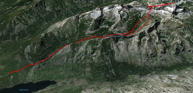
Out and Back Route for El Capitan Summit
No, not the El Capitan but the Montanan's El Capitan. Every state with mountains has an El Capitan peak. I've hiked several over the last few years. None are quite as impressive as Yosemite Valley's El Cap but climbing a peak with that name usually involves a long day of climbing with ample opportunities to scramble and bushwhack. Justin and I set off before dawn to give ourselves plenty of time to make the summit and be home for dinner. *Side note - Every foray into the mountains is carefully planned as to how long you can be out in the back country before you have several missed calls and voice mails from your significant other. You know what I am talking about...
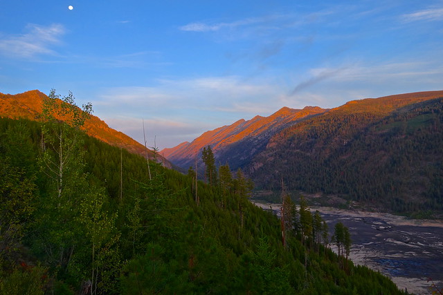
Western end of Lake Como from Little Rock Creek Trail Head
On Saturday morning we hopped in the Jeep and headed about 60 miles south on highway 93 and hooked west into the Lake Como recreation area. Once you get past the artificial Lake Como beach resort you follow a slightly maintained jeep road for a few bumpy miles up to the Little Rock Creek trail head. The sun was rising and just starting to illuminate the tips of the surrounding peaks. I love early summer mornings in the mountains... the air is so cool and crisp and everything is dead quiet.
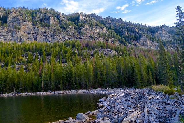
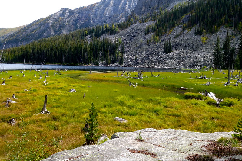
Eastern end of Little Rock Creek Lake
The first section of Little Rock Trail is mostly single track that meanders alongside Little Rock Creek. Every once and a while the trail dead ends into very sharp and awkwardly placed boulders. Each bouldering session would last for 5-10 min and then the trail would pick up again. Eventually the trail spits you out on to a mountain of driftwood signifying the start of Little Rock Creek lake.
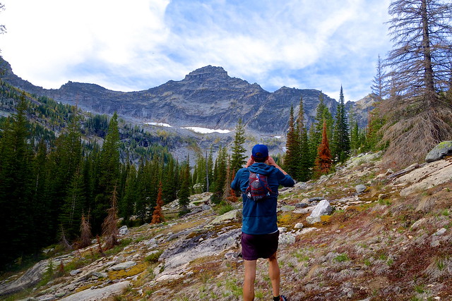
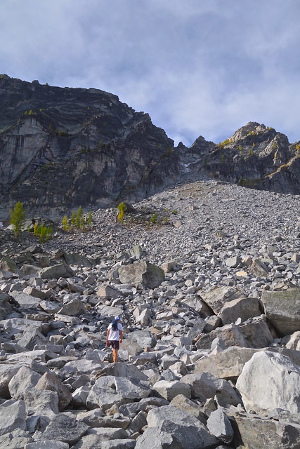
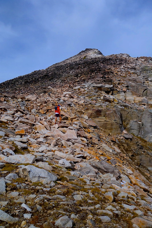
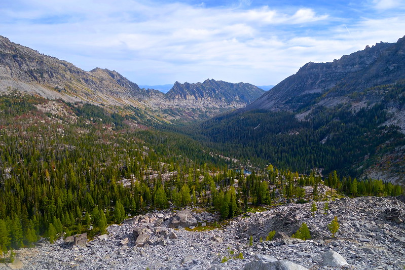
Justin taking in our first clear view of El Capitan Peak
Shortly after Little Rock Creek lake the trail just fades away into a creek. Justin and I ended up pushing south along the lake shore and then bushwhacking along a creek up to base of El Capitan. This section was pretty rough and annoying so I would recommend skirting north around the lake instead (which we did on the way back).
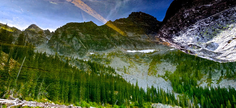
El Capitan reflection in an unnamed lake 2000+ ft below
Eventually you come up on three unnamed lakes at the base of the mountain. The water is crystal clear and provides great reflections of the beautiful scenery surrounding you. Once you take in the beauty of the remote lakes you can start to plan how you are going to approach the summit. There are several colouirs to pick from and none of them are particularly pleasant. Though we did find one that was easier than the rest...
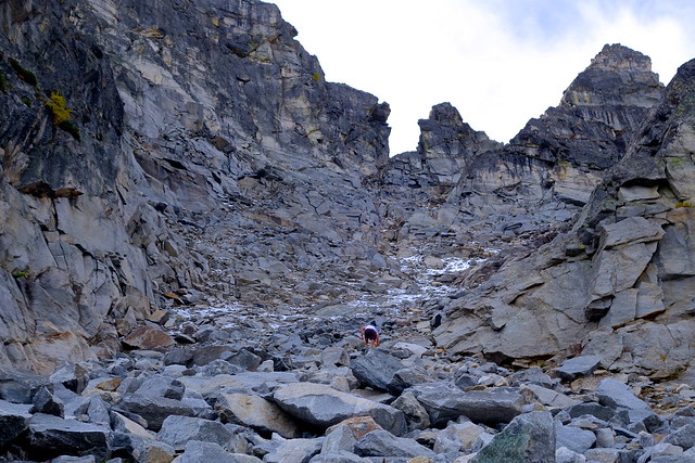
Justin leading up the colouir
We had already been hiking for a few hours when we hit this massive colouir. The first 100 yards were fun then we hit the shadow of the mountain... Really steep pitches with loose rock, mud, snow and ice. It wasn't a particularly long stretch by any means but it took the longest for us (me) to get through. Justin quickly bounded up the scree while I was slipping/struggling behind in my Hokas. Don't ever where Hokas on technical or wet terrain.
The wet, snowy, muddy top of the colouir
Once you get past the top of the colouir the rest was easy. Immediately you are rewarded with views of what is referred to as the cathedral consisting of several surrounding peaks in close proximity including El Capitan, Lonesome Bachelor, the Como Peaks and a few others. We weren't even at the summit and the views were already incredible.
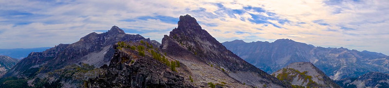
The Cathedral
The Final Approach/Slog to the Summit
The last few pitches up to the summit look pretty steep but they aren't bad at all. The rocks are really unstable near the top though and you never know when your tired legs are going to crash through some loose boulders. You can also start to feel the altitude as you make your way up to nearly 10,000 feet.
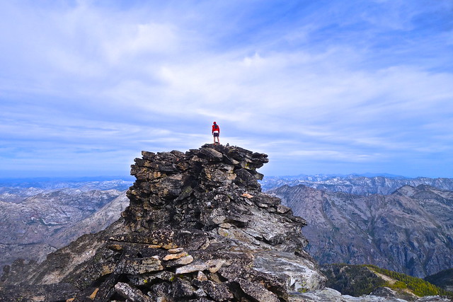
Justin peering into Idaho from Montana on the summit of El Capitan
This hike saves the best for last. To get to the actual summit you have to pull yourself up 20 feet of loose crumbling rock. It requires a good amount of upper body strength and some nerves. The drop down either side is a few thousand feet so if you have trouble with heights or vertigo you might now want to climb the last 20 feet. It felt really unstable and uneven up there. Have to wonder how long that loose rock will stay up like that!
Video I shot from the summit
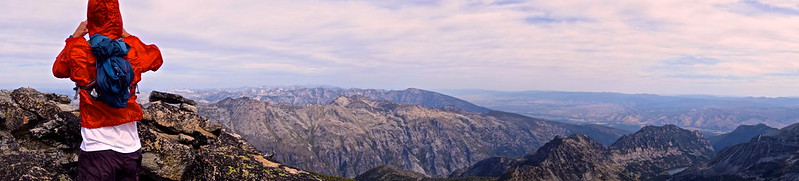
Looking north at the Bitterroot range
To the north you have wave after wave of 9-10,000ft mountains running east to west with creeks and valleys separating them. To the east you can see the famous Bitterroot valley, the Sapphire range and you can even see the Anaconda-Pintler range off on the horizon. Fall is fire season in mountain so the views are a little hazy.
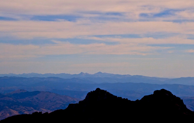
Looking east toward the Sapphire and Anaconda-Pintler Mountains
After 15-20 min on the windy cold summit we descended back down to the colouir. Except that when we hiked back all of the colouirs looked the same! We went back and forth between 3 or 4 different colouirs until we just went with one. It wasn't the one we went up and ended up being pretty dicey but we made it down ok.
Descending the colouir towards the three unnamed lakes
We took a short break at the lakes and plotted our next move. The vegetation/creek bushwhack was a slow slog so we decided to go north around the lake. Moving along the north side of the valley was so much easier. There were beautiful, open meadows with fire red wild flowers. So much better than the way out.
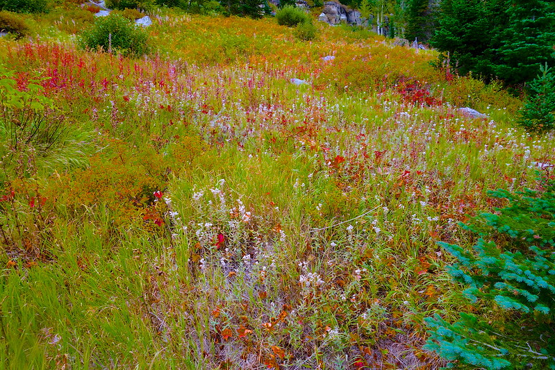
Beautiful wild flowers of the Bitterroot mountains
I really liked the western end of Little Rock Creek lake. The thick grassy meadows with virgin pine trees were so beautiful. The temperature was starting to drop as the sun was starting to retreat which made the hike back much cooler. As expected the hike back to the car always seems to take longer than the way out. With the excitement of summiting El Capitan hours behind us all we had now were achy muscles and hunger! The section from Little Rock Creek Lake to the trail head seemed to go on forever. Eventually we made it to the Jeep, grabbed some food and headed home.
El Capitan is a pretty remote peak but it is doable as a day hike. We had plenty of sunlight to spare even with making a few mistakes along the way. The views from the top were simply stunning and a little different than some of the northern peaks in the Bitterroots. Definitely one of my favorite hikes in Montana. I definitely underestimated the effort required for this summit. Justin and I were in pretty good running shape going into this and we were both feeling tired at the end. About 6,500 feet of climbing on the day. Nothing a few gas station chocolate bars and gatorades couldn't fix though!
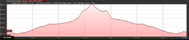
Elevation profile for our El Capitan hike about 6,500 of climbing

Comments
Post a Comment