Searching for Ch-Paa-Qn Peak
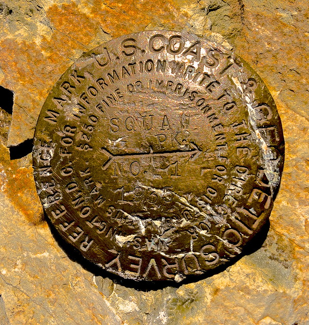
I've been in Missoula for almost 2 years now and have run / climbed almost every major peak in the Missoula area: Sentinel, Jumbo, Sheep, Blue Point, University, Radio Towers, Dean Stone, Blue Mountain, Lolo, Point Six, Stuart, Murphy... etc. The one last major peak (Black Mountain is still on my list) I had not climbed was Ch-paa-qn or "Squaw" peak. Ch-paa-qn is Salish for gray, treeless mountain.
Ch-paa-qn is roughly 25 miles west of Missoula. A quick drive down I-90 to the nine mile drainage and then about an hour drive up a rough, old forest road via Edith Peak Rd and you are at the edith peak trail head. Since I am injured I decided to ride my bike up instead of driving. I didn't see anyone on the way up until I hit the trail head. There was a couple inside a car who looked at me like I was in idiot for riding my bike up there. Pretty standard.
The trail leading to the peak is around 3 miles and heads west the entire way to the base of the peak. The first 2 miles of trail are heavily vegetated and not regularly maintained. It was a bit nervy during the first 30 min because the vegetation was over my head and I was hiking alone. My expired bear spray was locked and loaded and fortunately never called for action. The bear spray was in the front of pack because I've heard that two male grizzlies live somewhere on this mountain.
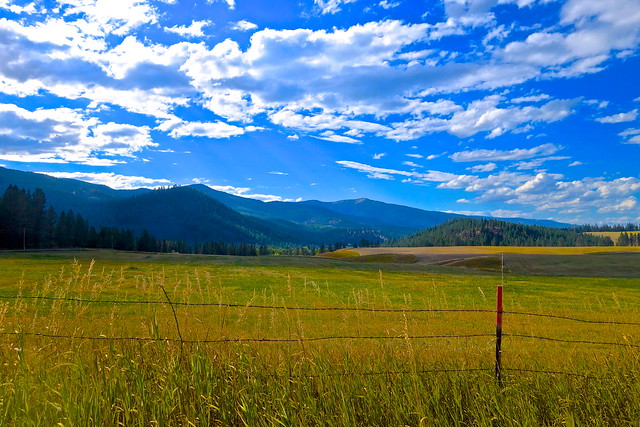
After swimming through a sea of vegetation for the first two miles I was happy to exit into the first clearing. The grassy meadows were so peaceful with only the birds occasionally interrupting my well earned silence. I did sneak up on a few sage grouse but instead of surprising me with their deafening flutter, they turned to stone and let me pass in silence.
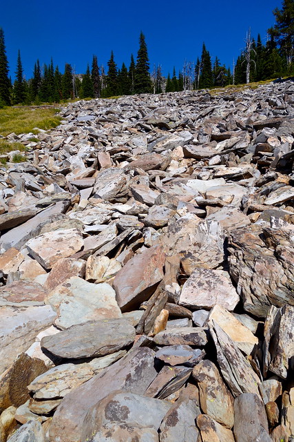
Then out of nowhere long rock chutes appear from the North. From this point on it's your choice as to when you want to head up to the summit. I chose to walk for a while on the trail before bouldering to the summit.
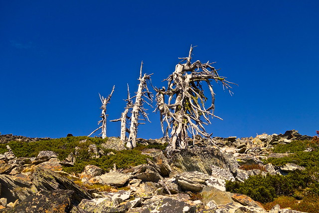
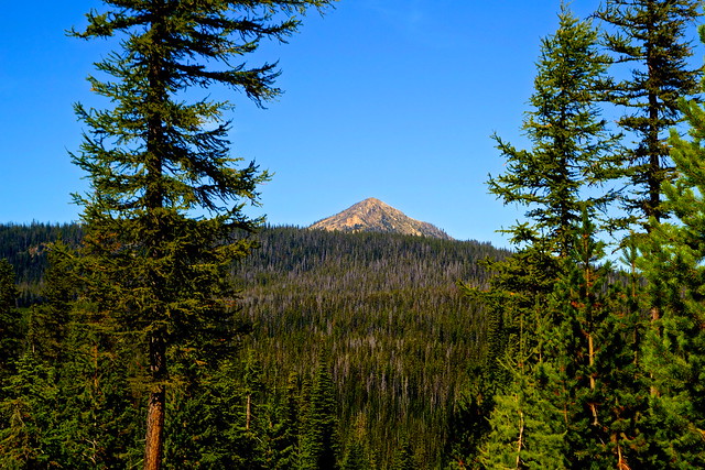
The initial part of the climb weaves through small pockets of forest. About half way up you clear the tree line and enter shrub country. However, there are a few old, dead trees swaying and creaking with the summit winds. I would be lying if I didn't say it was a bit ominous.
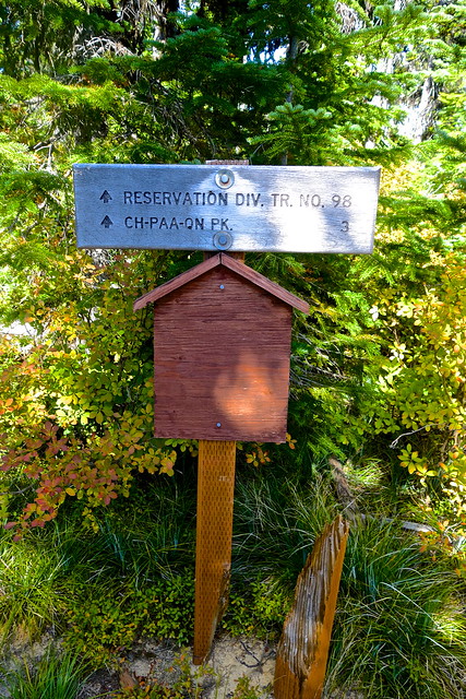
After 9 miles of biking and 3+ miles of hiking I finally reached the summit at 7,798 ft. I hadn't seen anyone since the couple in the parking lot - who were debating whether or not they should hike or just go home. Only 5 minutes on the summit and I could already hear people approaching from the south. They had taken the alternate route via the Reservation Divide Trail (3.5 miles 1,800 ft ascent) which they claimed had quite a bit of traffic. That validated my decision to take the less traveled and more climbing option via the Sleeping Woman Trail (3 miles 2300ft ascent).
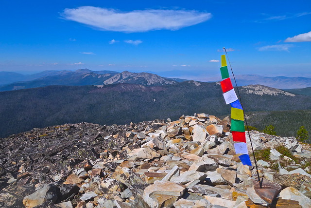
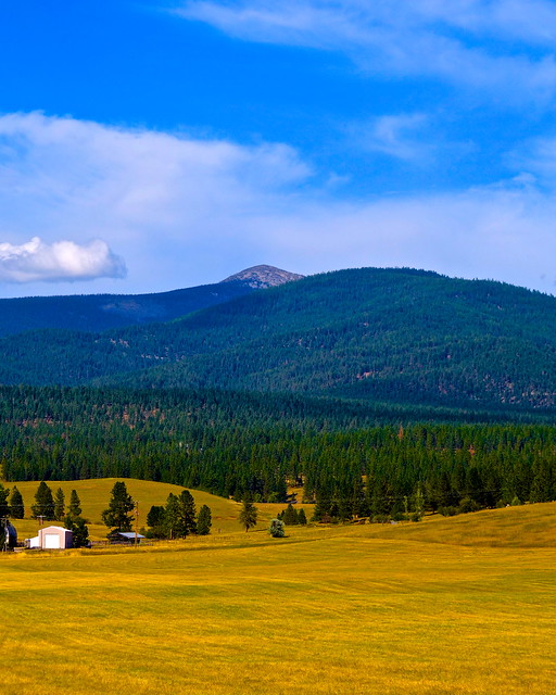
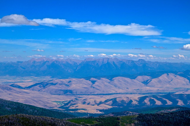
Ch-paa-qn can be seen from almost anywhere in the Missoula Valley. The nearly 8,000 ft peak prominently towers over the nine mile drainage with no other peaks challenging it. Needless to say the views from Ch-paa-qn are incredible.
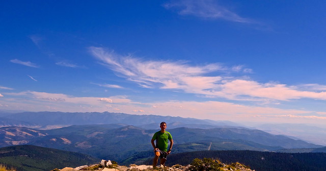
The best views included the Bitterroots and the Missions. This particular summit provides a really unique perspective of the Mission Range.
After chatting with the guys on the summit and a quick snack I headed back down to the trail. I took a different route back and was rewarded with beautiful meadows full of bright red shrubs.
Ironically, I passed no fewer than 5 groups on the way back to the trailhead. Thought it was kind of strange since I was late getting to the summit myself and these folks had a ways to go. Hiking this trail at night would be fun with a group but the vegetation and rock slides would make it interesting!
I took one final glance back at the summit while cruising back down Edith Peak Rd on my bike. My last major summit in the Missoula area did not disappoint. If you are willing to make the drive from Missoula this is very easy hike, if not the easiest hike I've done, for the area. This trip would be amazing on skis during the winter. For those who want to break away from the Rattlesnake, Sentinel and Blue Mountain crowds this is a great day hike option that provides unique views of the Missoula and Mission Valleys. If you bring binoculars you can just see the South end of Flathead Lake!


Chris,
ReplyDeleteI caught your result from Bryce. Nice work. Everything holding up? What's on tap?
jer
Thanks Jeremy. You should get out to the Bryce race at some point. Really beautiful and unforgiving country. The entire race is between 7500 and 9500 feet and mostly on sand... but really the views are worth the suffering. Toughest finish to any race I have been in before. Not sure if you know this but I moved to Sierra Madre, CA a week ago. So I am exploring races here in SoCal while enjoying an abundance of new trails and peaks in the San Gabriel mountains! I'll be building up fitness until NF50 in San Fran. How about you? How is training going? Any races coming up? - Chris
ReplyDeleteFeeling good after a 100k last weekend. Haven't really started training, but the next 6 weeks is when I pick it up and hopefully hit a good summer peak. UTMB is next for me. Sierra Madre sounds like a great place to be a runner. Year-round access to big terrain. A perfect place to train for a race like Western. Lucky guy. Just hope you can get that community of strong runners to train with that Missoula had. I am looking into one other late-season race, but if that falls through then I will do TNF50 with you.
ReplyDelete